Your Complete Guide to Visiting Highway 1 in Big Sur California
Disclaimer: This post may contain affiliate links. This means I may receive a small commission at no extra cost to you. The reviews of the items in this article are based on my own opinions. Disclosure policy https://www.adoptinglifesjourney.com/blog/disclosure-policy
BOOKMARK THIS BLOG POST AS IT WILL BE HELPFUL WHEN PLANNING YOUR TRIP TO BIG SUR
Big Sur, California
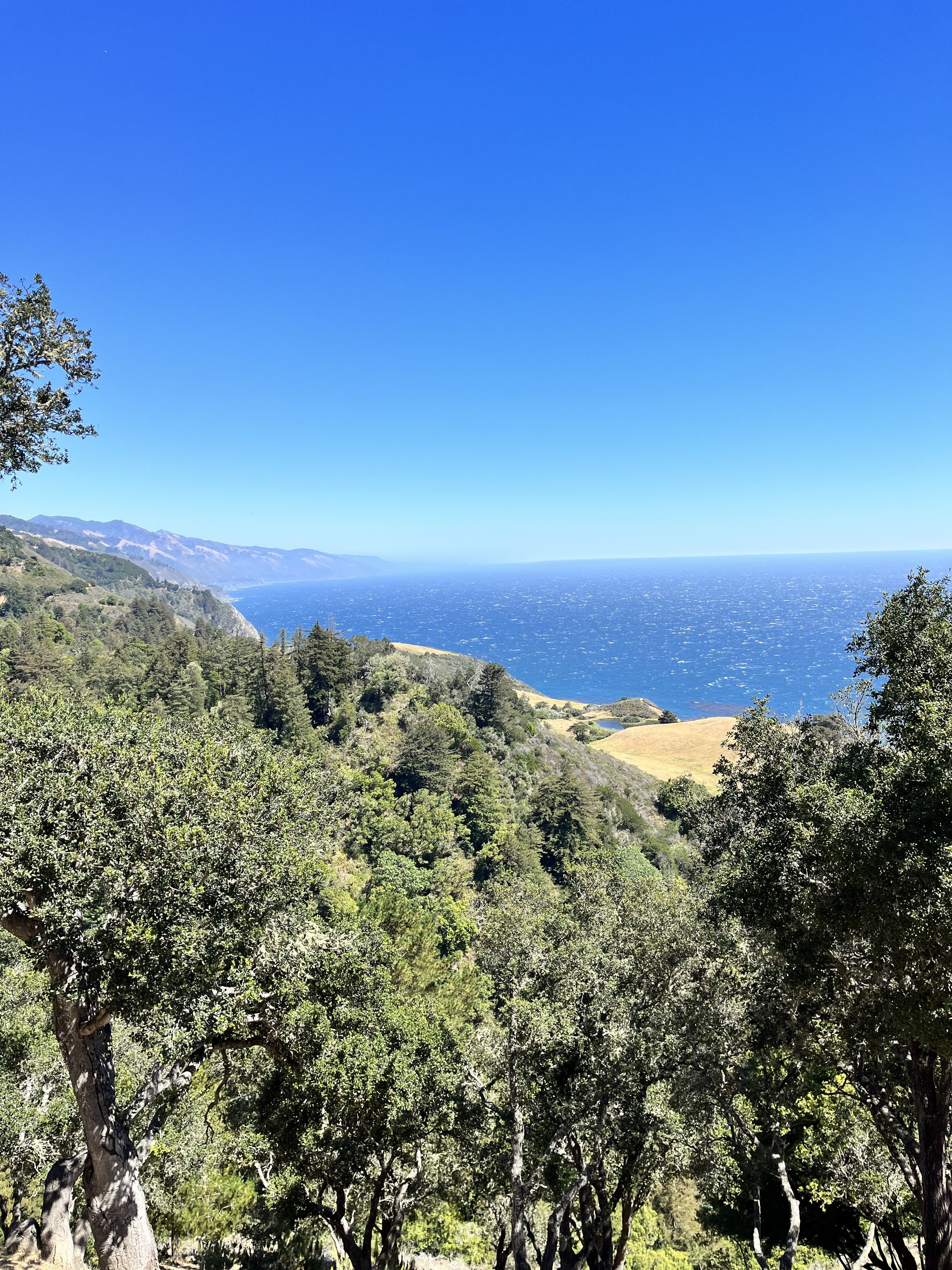
Sitting along the rugged coastline of central California, Big Sur provides a breathtaking landscape full of natural beauty that captures the soul. Highway 1 spans over 90 miles between Carnel and San Simeon, the iconic location is known for its dramatic cliffs, towering redwoods, and the most amazing ocean views. There is no comparison to this escape in nature as you explore state parks, hidden beaches, majestic waterfalls, and unforgettable hidden gems along the coastline of California. This guarantees to be an unforgettable must-visit destination.
If you have never been to Big Sur, you have to make the time to travel along highway 1 to see these beautiful stops along the way. Highway 1 spans along the pacific coast of California and can be visited in a full day trip but is better done in a couple days as there is so much to see. There are multiple stops along the way where you can get out and enjoy the sprawling landscape along the coast with some pretty dramatic views. You will see ocean views, famous Bixby Creek bridge, purple sand at Pfeiffer beach, waterfalls and waves crashing along the coastline. There are a few places to stop, eat and camp along the way. We traveled this highway during the month of June for your reference.
There is no fee to travel along this highway.
There is limited cell signal along this route.
There are limited gas stations, so fill up before you start your trip along Highway 1
Explore Highway 1 along Big Sur in this full day tour from San Francisco. Experience the 17-mile drive from Carmel to Monterey. Prices start at $127
Maps of Big Sur
I am including three different maps that I used as I traveled this route along Highway 1. There is very limited to no cell service along this route so print these maps out or download them for reference along the way. These maps include the North, Central, and South areas of Highway 1. I only used the north and central maps for our journey. If you have time, you could make more stops using the south map as well.
If you travel north to south, you will have a much better view of the magnificent Pacific Ocean as you travel.
Mile Markers for Reference along Hwy 1
Each map below has the mile marker number to help you locate the stopping points along the route. This makes it so easy to find each location. These are the exact maps I used as we traveled this route. Useful guide: Highway 1 guidebook.
We did this route from north to south and then back up north again in one day. There is so much to see along this route that if you have the chance to camp and take a couple days to enjoy more of the sights, I highly recommend it.
Pin this image to reference later
Garrapata Beach
Our first stop was Garrapata Beach at mile marker 63. There is such a beautiful view of the beach here. You will park on the side of the road and take the small path down to the beach. It is a quick easy trail which starts at the path from the picture below. I loved the flowers along the path which made this view even more special. It was very windy on this beach so be prepared with a light jacket for comfort. This will be a quick stop although you can spend as much time here as you like. I would suggest you take a picnic lunch to this location but again, it was really windy when we were there.
Hours: 8am to 1/2 hour before sunset
Pets: allowed on a leash from Gate 19 only
No camping allowed
Bixby Creek Bridge
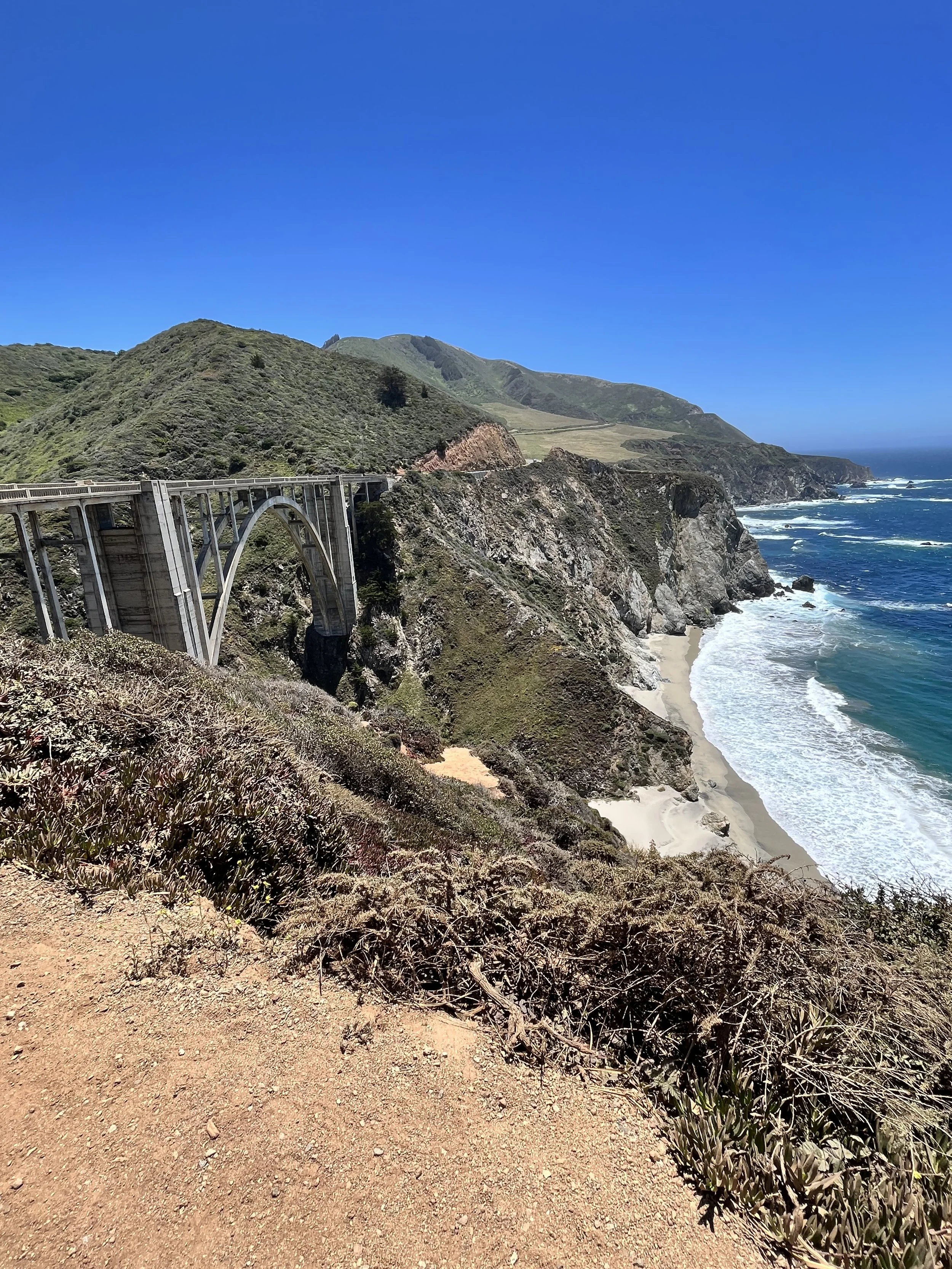
Second stop is at Bixby Creek Bridge at mile marker 59.90 (also known as Bixby Canyon Bridge or Bixby Bridge). This is a famous iconic bridge that you will see throughout social media. This bridge was built in 1932 and is one of the highest bridges in the world soaring over 260 feet above the canyon.
Wildflowers, when in bloom, make a beautiful backdrop to this location. This was such an amazing view that I could have stayed here for a long time just staring into this magnificent ocean view. There is a small area to stand for pictures along the dirt but be aware of the drop off, so you don’t fall.
Parking is very limited at this location. There is a small parking area for your use.
This location is FREE to visit.
Pfeiffer Beach
Next is Pfeiffer Beach between mile marker 45-46. (this is NOT Pfeiffer State Park). This area is known for its rocky arches and purple sand!! Yes, purple sand. It was so cool to see!
Go slow near this stop as it is hard to find. When you see the Big Sur Lodge on your left (going south), it’s not too much further. It’s a right turn off, that almost feels like a U-turn. You’re looking for a yellow “narrow road” sign (as seen in below picture) and Sycamore Canyon Road, this is a sharp turn-out on the right side of Highway 1.
After turning, you’ll follow that road for a few miles, past houses and pastures with horses, and eventually you’ll end up at the parking lot. You drive on a sketchy one lane narrow road to get to the parking area. Parking is limited and fills up quick. You may not be able to enjoy this area if you can’t find a parking spot or you may have to wait.
There is a short walk from the parking lot to the beach. It was very windy here as well so don’t forget your jacket. I love wearing Teva sandals as we travel. I can use them for short hikes or to hike through water. They are so versatile, and I highly recommend you get a pair for your travels. #teva
Cost: $15 day use pass. Cash preferred.
Hours: 9am to sunset
Amenities: vault toilets, self-pay station, beach access
No camping
No walking, RV’s or trailers allowed on this road.
Take this guided electric bike tour along the scenic coast and through the town of Carmel. Prices start at $75
Nepenthe Restaurant
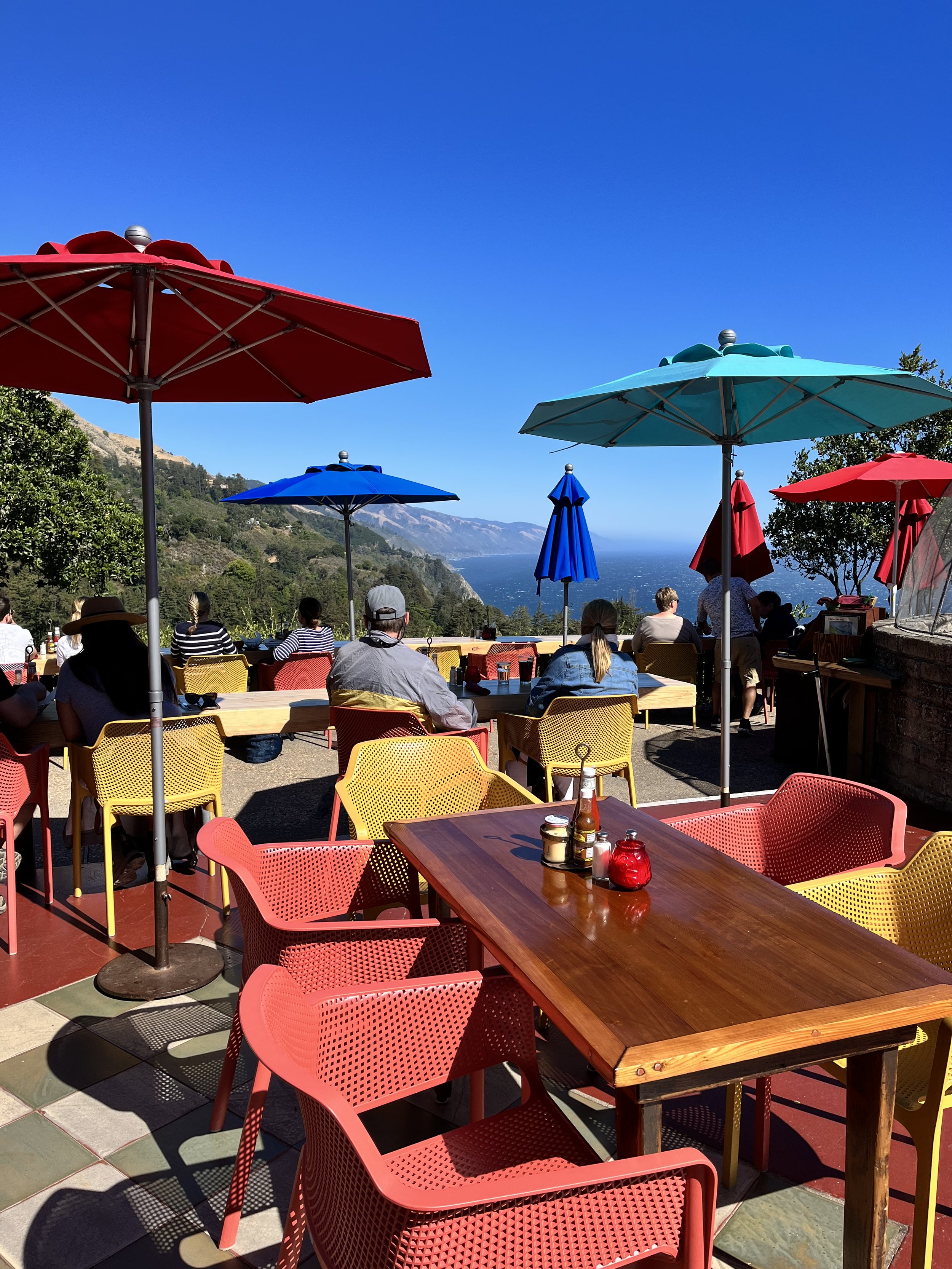
Make a stop at Nepenthe Restaurant at mile marker 43.9 for lunch. What made this restaurant worth the stop is the beautiful view of the Pacific Ocean while sitting outside on their back deck. There was a minimal wait of about 20 minutes while we were there.
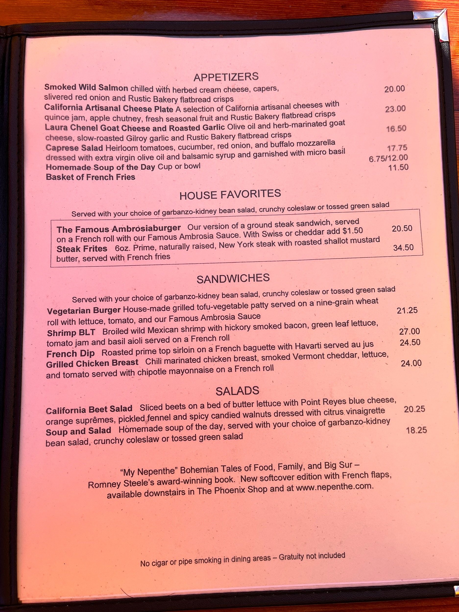
There is outdoor and indoor seating. The food is a little pricey, as you would expect from this location, and it was not my favorite meal, but the view makes you forget about all of that. You will also find a cute little shop on the property where you can purchase souvenirs such as glassware, jewelry, books and stationery, post cards, kitchenware and so much more.
Hours of Nepenthe Restaurant: daily 11:30am to 10pm. Lunch 11:30am to 4:30pm. Dinner 5pm to 9pm. Closed on Thanksgiving and Christmas day. No reservations needed. Menus in pictures below (2022 menu, 2024 hours).
Hours of The Phoenix Shop: daily 10:30am to 6pm for Nepenthe souvenirs and other items such as jewelry, books, artisan wares, and specialty items.
Hours of Café Kevah: daily 9am to 3pm weather permitting. Closed in the winter months.
RV/Bus/Trailer parking on the large dirt turnout on the highway, not in the parking lot.
Pets allowed in The Phoenix Shop only
Partington Cove
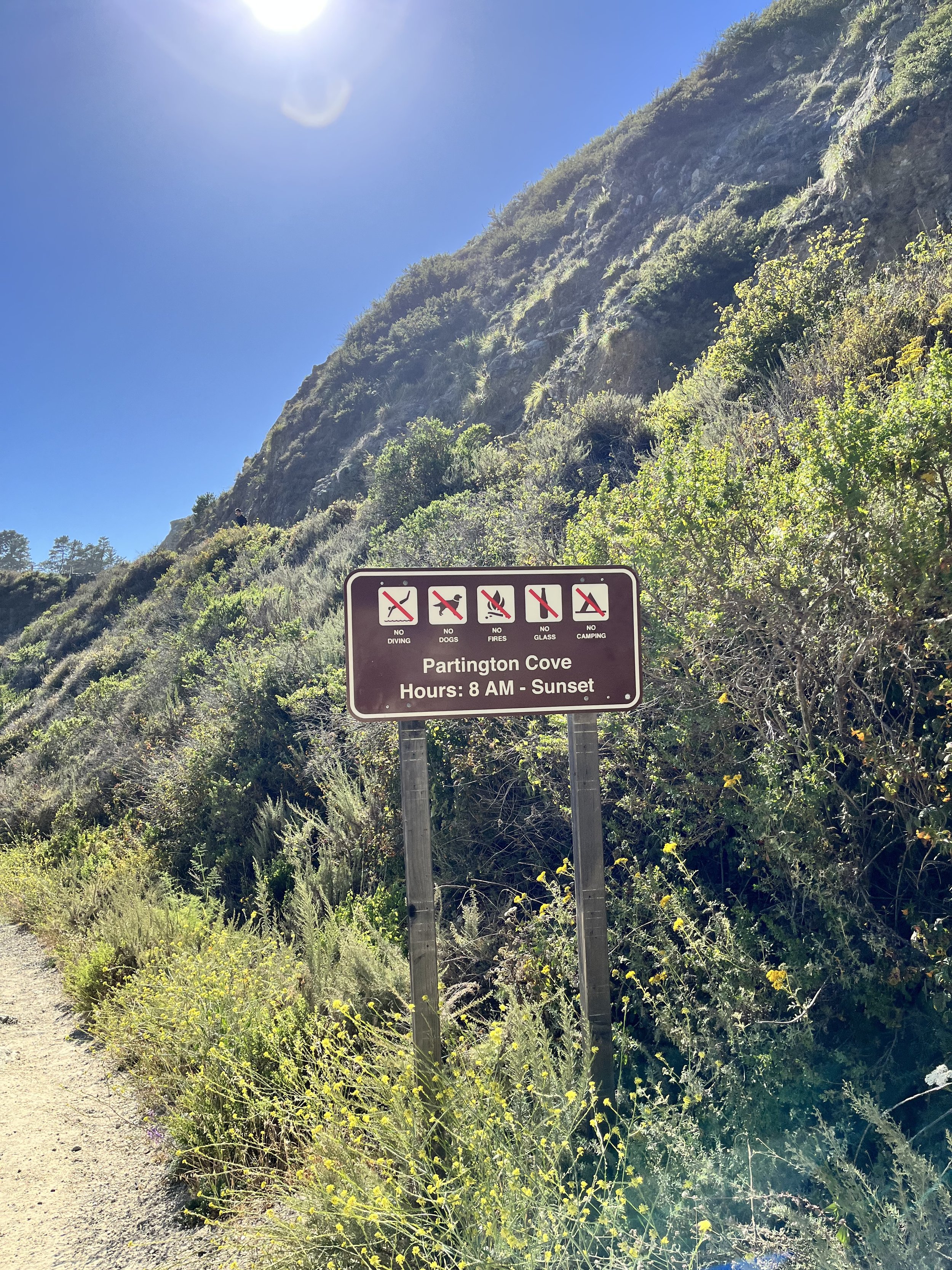
Onto Partington Cove at mile marker 37.85. You will park on the side of the road on Highway 1 and go around the green gate down the dirt road to the cove. This is a little over a mile hike, round trip, down a steep hill. This area is part of Julia Pfeiffer Burns State Park but has a separate entrance.
After a bit of a walk, you can go one of two ways.
Going to the left, you will cross a wooden bridge and you can go straight through the 60-foot tunnel for a nice view of Partington Cove. This area was used to transport tanoak and redwood to Santa Cruz and San Francisco in the 1870’s. It is a short walk through the tunnel for a view of the cove.
Or you can go to the right to the Partington Point cove where you will encounter large boulders where the water crashes up against the rocks for a dramatic effect. See more info below on Partington Point.
Hours: 8am to sunset
Swimming is not recommended at either cove. Scuba diving is allowed with a special permit.
No restrooms and no pets allowed
Partington Point
You continue onto Partington Point. It is a short walk to the cove. Once at the cove you can sit peacefully on the large rocks and just watch the waves crash onto the rocks for hours. I found it rather peaceful. Be careful because you do have to walk over a lot of larger boulders to get close to the water. Do not attempt to go into the water! Due to the large waves this area would be dangerous to swim in. You can get a good view without climbing over the rocks as well. Again, I love my Teva Sandals for hikes like this. This is definitely worth the hike as it is so beautiful.
The hike back to your car is steep but doable, so take your time.
McWay Falls at Julia Pfeiffer Burns State Park
Next stop is at Julia Pfeiffer Burns State Park to view McWay Falls which is near mile marker 35.8. This park was named after a late pioneer woman who lived in the area.
This was one of my favorite views along Big Sur. There is a 1/2-mile hike (about 10 minutes) to enjoy this beautiful 80-foot waterfall that drops from the granite cliffs into the ocean. You cannot access this waterfall, or the beach and it is a citable and arrestable offense if you try, but you can view it from the top of the trail. There are 6 other trails within this park to enjoy also. (Most trails were closed as of March 2023)
Hours: 8am to sunset.
Cost: $10 per car. You can pay at the self-pay stations near the restrooms. Some people park on the side of the road before entering the park and walk down the stairs to the falls to avoid this cost. Be very careful parking on the road and know it isn’t an actual parking area so park at your own risk.
Restrooms and drinking water available
No pets allowed beyond the parking lot
Hiking Trails
Waterfall Overlook Trail/ McWay Falls - 0.5-mile roundtrip
Canyon Trail - .25-miles to the waterfall CLOSED AS OF MAY 2024
Ewoldsen Trail - 5 miles CLOSED AS OF MAY 2024
Waters Trail - 1 mile one way CLOSED AS OF MAY 2024
Tan Bark Trail - 3.2-mile one way
Tin House Road - 2.3-mile one way
Partington Cove Trail - 1 mile roundtrip (see details above)
Camping at Julia Pfeiffer Burns State Park
Camping is available for a minimal fee at the two environmental campsites. These are walk-in sites only. No cars allowed.
Check in is at 2pm.
No pets allowed and a maximum of 4 people per camp site.
Cost: $30 a night.
Amenities: picnic table, fire ring, pit toilets, trash cans. Restrooms and water are available across Highway 1.
Social Media @bigsurstateparks
Highway 1 is closed 5 miles south of Julia Pfeiffer Burns State Park due to landslides as of May 2024. No alternative route.
〰️
Highway 1 is closed 5 miles south of Julia Pfeiffer Burns State Park due to landslides as of May 2024. No alternative route. 〰️
SEE HIGHWAY 1 CLOSURES MAP BELOW. UPDATED MAY 2024.
Carmel Beach
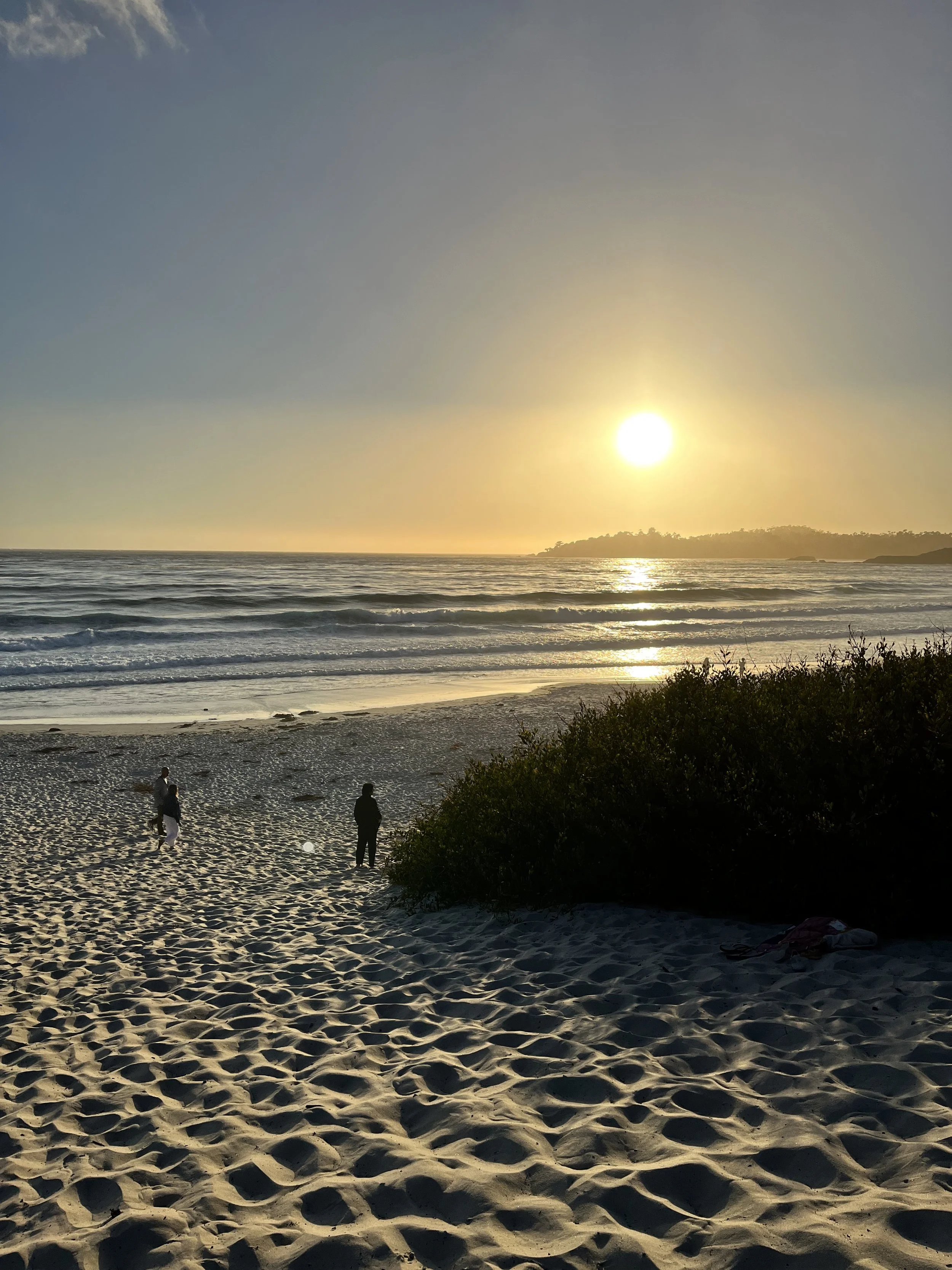
After we finished at McWay Falls we headed back north along Highway 1 Big Sur and ended the night at Carmel Beach. We ended with a sunset on the beach surrounded by white sand and beautiful blue ocean water. It doesn’t get better than that. After the sunset we walked through the charming town along Ocean Ave to do a little shopping.
Dogs are allowed off their leash at this beach as long as they respond to their owner’s commands.
Beach fires are allowed on the beach
Parking: Free along Ocean Avenue
Things to do in the area: There are several things to do within this area such as shopping, restaurants, wine tasting, artistic fares, hotels and more.
Accommodations: Looking for a place to stay while in Carmel? Check out local hotels at booking.com
Camping along Big Sur
We did not camp along Big Sur during our time there as our goal was to save money but there are several camping options within Big Sur. I would definitely try a campground next time we visit the area. Instead, we stayed at the back of a hotel close by. Not a legal overnight parking spot but it worked for me.
If you choose to stay at one of these campgrounds you could take your time along Big Sur and be able to stop at more locations along this route.
Here are several campgrounds I found along the route that seemed to have good ratings. If you stay at one of them let me know your reviews of the campground in the comments below so I can add it to my list of places to stay the next time I am in California. (campground prices 2023)
Riverside Campground & Cabins. 34 sites for tents/RV and 12 cabins. Amenities: picnic table, fire pit, hot showers, laundry, and restrooms. Electricity and water available at RV sites. River tubing nearby.
Pfeiffer Big Sur State Park. 189 RV and tent sites. $35-50 a night. Amenities: fire pit, picnic table, water, hot showers (tokens-$1.00 = 5 minutes), toilets and dump station. No hookups.
Fernwood Campground and Resort. RV ($85-105 night- water & electricity)/tent/motel ($180-235 night)/cabins and more. Amenities: restaurant, general store, tavern, events, camping supplies, hiking.
Ventana Campground. TENT CAMPING ONLY. Amenities: bath house, water nearby, picnic table, fire pit.
Big Sur Campground & Cabins. Tent/RV (water & electric)/Cabins. Amenities: picnic table, fire ring, bath house, dump station.
You have to add Big Sur to your bucketlist!!
I cannot recommend this area enough. It is absolutely breathtaking, and you will not be disappointed. Check out the above maps, research the area and circle the locations you want to stop along your route on Highway 1. Remember there is very limited to no Wi-Fi along highway 1 so I recommend circling the stops on the map above where you want to visit so you are prepared when you travel. The areas I would definitely stop at again and recommend you add to your list are:
Bixby Creek Bridge
Pfeiffer Beach to see the purple sand
Partington Point
McWay Falls at Julia Pfeiffer Burns State Park
Carmel Beach
Nepenthe Restaurant had an amazing view but I would try another place to eat during our next trip.
Where to stay when visiting Carmel along Big Sur
Coachman’s Inn - the cutest hotel within a 15-minute walking distance to Carmel beach. Breakfast is included.
Horizon Inn & Ocean View Lodge - this hotel is located 1-mile from Carmel beach and offers complimentary breakfast.
L’Auberge Carmel, Relais & Chateaux - this exquisite chateaux provides a sense of luxury and is within walking distance to Carmel beach. Feel pampered with in-room massages, bar, on site restaurant, and breakfast.
Items I recommend for your trip to Big Sur!
Light jacket - some of the beach areas are cooler and a light jacket will be needed
Road Atlas - I like to have an atlas on hand for when I do not have cell signal
Lululemon belt bag - I use this every time we travel to carry my keys, phone, ChapStick, hand sanitizer, and more as I am hiking
Teva sandals - I wore these sandals our entire trip. I love the fact that I can hike on land or in water with them
Water bottle - a water bottle is necessary to keep you hydrated while hiking along Big Sur. We us two different water bottles, Nalgene or Hydrapeak
Portable phone charger - keep your cell battery charged while on your trip
Check out related blog posts
Santa Cruz Beach Boardwalk in California. Voted Best Seaside Park
6 of the Best Places to Visit in San Francisco, California with kids
Your Guide to Joshua Tree National Park and Camping Location
Feel free to reach out to me with any questions or observations you have regarding this area. There is so much to see and do along this route you would benefit from spending a couple days in this area.
What is your favorite stop along Big Sur? Comment below.
Enjoy your next journey,
Meet the author: Jennifer
I am a girl who loves to travel and enjoys sharing expert family travel advice. I am a content creator and influencer on Instagram with years of travel experience and provide readers with advice, tips, and details on adventurous family travel and tips on saving money while boondocking or traveling across the US. Pic: Nassau, Bahamas
Follow me on social media to discover more travel ideas
Instagram @adoptinglifesjourney
Pinterest /adoptinglifesjourney
If this post was helpful, follow me on Instagram @adoptinglifesjourney and
Hashtag your photos at #adoptinglifesjourney
Need help planning a vacation? I am also a travel agent. Follow me on social media and send me a DM @exploringsunsetstravel for more travel inspiration or for a FREE travel quote.
Evolution Travel - Jennifer Sloan (evotravelagent.com)
Like this post? Pin it for later












Nassau is a bustling cruise port and a popular destination when traveling in the Bahamas on shorter cruises from Florida. This port offers everything from mouthwatering local cuisine to stunning white-sand beaches and rich Bahamian heritage.