A List of Free Boondocking Locations across the United States
Disclaimer: This post may contain affiliate links. This means I may receive a small commission at no extra cost to you. The reviews of the items in this article are based on my own opinions. Disclosure policy https://www.adoptinglifesjourney.com/blog/disclosure-policy
Updated June 2024
New Boondocking locations in Virginia, West Virginia
〰️
New Boondocking locations in Virginia, West Virginia 〰️
Boondocking across the US
What is bondocking? Boondocking, also called dry camping, is camping on public land or sometimes private locations that have limited facilities and are often off the side of a road or in the middle of nowhere. Most locations are FREE and have a limited time you can stay at each location. Typically, up to 14 days within 30 days.
When you embark on a boondocking adventure across the United States it provides a unique travel experience. Getting away from the typical campgrounds to enjoy a boondocking experience such as camping without amenities in remote areas and scenic locations will allow you to immerse yourself in the raw beauty of the land in a way others may never experience.
Whether you are boondocking among the towering pine trees in a national forest, parked at the edge of a mountain with exceptional mountain views, staying in the solitude of the desert, it all provides an opportunity for exploration in the most magical and peaceful settings you can imagine.
Often times you will find these locations with little to no people around offering the joy of silence. Since there are no streetlights, the star lit skies can be absolutely amazing as well.
Boondocking is something I first experienced the summer of 2021. I had camped before in a travel trailer but never without amenities such as running water and a toilet. I loved that camping experience and was eager to try and boondock for the first time in a campervan.
Get Your FREE Printable list of free boondocking locations across the US below
〰️
Get Your FREE Printable list of free boondocking locations across the US below 〰️
List of boondocking locations
I have created this list of boondocking locations as a reference for anyone looking for a quick guide of places to stay across the US for FREE. Almost all of these locations are FREE or require a minimal charge. Some of the locations are free because we have an America the Beautiful National Park Pass. The pass costs $80 annually.
This post will be ever changing so bookmark this page to reference later or sign up for my newsletter so you can be the first to know about new boondocking locations. As I experience new locations I will add them to this page. Each location on this page we have personally stayed at and recommend. Check back often for new locations. All reviews are my personal experiences at each location.
Location amenities may change without notice, area safety and cleanliness may change as well over time. Stay at your own risk and research the area thoroughly before you stay at each location. My opinions are based off of our needs and each location is based off of weather, timing, and the area during a specific time we stayed there. Things can change over time so always go prepared.
States are listed in alphabetical order below. APPS used for locating boondocking locations are listed at the end of the blog post. I am not a gatekeeper to these locations; they are meant to be shared with others so you too can enjoy these beautiful boondocking locations. You can find most of these locations on Apps such as iOverlander so I am not giving you information you cannot find on your own.
States included in this list
Arizona
California
Colorado
Florida
Georgia
Illinois
Indiana
Kansas
Louisiana
New Mexico
North Carolina
Tennessee
Texas
Utah
Virginia
West Virginia
Arizona
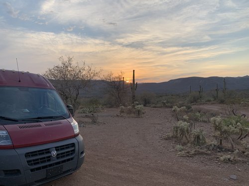
This boondocking location is located off of W Table Mesa Road on N Little Grand Canyon in New River. There is a pretty bumpy dirt road to this location, and it is very isolated. The temps were 111 degrees at night in June so if you stay here, you will want air conditioning in your vehicle. There were a couple of other campers there when we arrived but they were at a distance so you still could feel a sense of privacy. There are wild donkeys in this area which we could hear in the distance but did not see any although there was lots of donkey poo where we parked. There are also Saguaro cacti at this location which I loved. This is a really long road with multiple spots to camp at, you can just park wherever you feel comfortable.
Cost: FREE. No reservations needed.
Amenities: Some rock fire pits
APPS: Campendium, iOverlander (called Table Mesa Trailhead/Road Area)
GPS: 33.98958, -112.173981. GPS for this location takes you to a certain spot on the road but you can camp before or after that location.
Kaibab National Forest in Williams. This is located on a washboard gravel road surrounded by pine trees. This campground was so beautiful as you camp among the pine trees, and I highly recommend this camping spot if you are in the area. There are a LOT of campsites along this long road, and although it was full when we arrived, we were able to find probably the last campsite along this road. There are some areas where you can camp in groups or find your own spot along the road. Most spots are next to the road so although it is peaceful, there is limited privacy.
Cost: FREE with a 14-day limit
Amenities: rock fire pit, shade trees
Apps: iOverlander
GPS: 35.19315, -112.13664 — This GPS is located at the beginning of Fire Rd 110. You keep going until you find a spot you want to camp.
Cell Signal: Yes, Verizon
This spot is located 1 hour 7 minutes from Grand Canyon National Park
California
Oak Flats Campground is located in Angeles National Forest. This campground is free with a National Park pass. Located at the Oak Flat Fire Station in Castaic. This campground is located off the highway on a paved road and is open year-round. There are 20 campsites at this campground and are on a first come first serve basis. This area used to be heavily populated with the homeless therefore while we were there a park ranger stopped by to make sure we were ok and to make sure we had our pass. He stated he surveys the area often to make sure there are no homeless people living here anymore. I felt safe at this campsite.
Cost: FREE. America the Beautiful National Park Pass is required
Amenities: Vault toilets, fire ring, picnic table. NO water or hookups.
APPS: Campendium (Oak Flat Campground)
GPS: 34.600451, -118.722081
Cell: Yes, Verizon
Maximum RV/trailer length: 22 feet
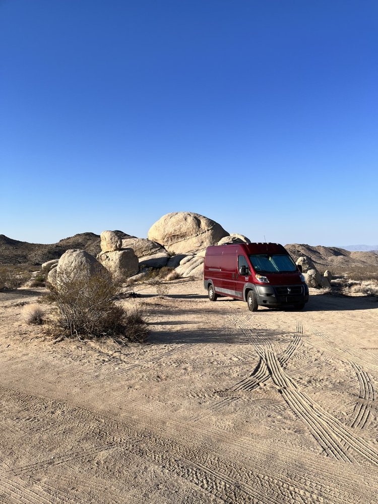
Located in Mojave National Preserve in Amboy. This location is 2.5 miles from highway 40 and is off of Kelbaker Road. This was a great location to camp at as you camp among the large boulders, nestled in the desert crying for you to climb. The area was sandy so please get out and check the area before you find a spot to camp. There is no shade in this location. There is room for a couple campers at this location. Take traction boards just in case you get stuck.
Cost: FREE with a 14-day limit
Amenities: Rock fire pit
APPS: iOverlander (Boulders off of Kelbaker Rd), Campendium (Kelbaker Boulders), The Dyrt (Kelbaker Boulders Dispersed - Mojave National Preserve), Free Roam (Off Kelbaker Rd)
GPS: 34.74561, -115.65202
Cell: Yes, Verizon
Other boondocking locations in this area can be found on the NPS website.
This spot is 1 hour 10 minutes from Joshua Tree National Park
Colorado
Marshall Pass in San Isabel National Forest in Salida. I unfortunately didn’t get a picture of this spot but wanted to include it as it was another great FREE location. When we pulled in right before dark it was full of campers but luck fully there was one spot left. Most of the other campers were hauling 4-wheelers so this is definitely the spot to be if you plan on doing some off-road adventuring. The road is rough going up to it but wasn’t a problem in our campervan.
Cost: FREE with a 14-day limit. No reservations needed.
Amenities: Fire ring only. No restrooms.
APPS: Campendium, iOverlander (similar area but different GPS)
GPS: 38.42303, -106.13297
Pike and San Isabel National Forests in Woodland Park. This location was beautiful, and you could see Pikes Peak from our camping location.
Cost: FREE with a 14-day limit. No reservations required. There were several camping locations throughout this area. The area we chose had a lot of washboard areas and larger rocks to travel over once we found this spot. Doable in our 2WD ProMaster but take it very slow.
Amenities: There are no amenities at this location. Fires were allowed.
APPS: iOverlander (similar locations), FreeRoam (Cascade-Chipita Park) on same dirt area.
GPS: 38.96889, -105.00831
This location is 22 minutes from the entrance to Pikes Peak and 43 minutes to Garden of the Gods
Camping spot below shows Pikes Peak in the background!
San Juan National Forest in Hesperus. Located off of County Road 316 Madden Peak Road. Easy location to get to and the camp spot is located on a grassy/dirt area right off the road.
Cost: FREE with a 14-day limit.
Amenities: shade trees, rock fire ring
APPS: iOverlander (similar sites)
GPS: 37.34765, -108.20158
Cell: No, Verizon
This spot is 18 minutes from Mesa Verde National Park and 1 hour 13 minutes from Four Corners National Monument
**Updated list June 2024** GET MY FREE PRINTABLE BOONDOCKING LIST THAT COVERS THE LOCATIONS IN THIS BLOG POST BELOW. GPS coordinates included PLUS a free Camp Cooking Supplies List.
SIGN UP WITH YOUR EMAIL ADDRESS BELOW TO RECEIVE THIS LIST.
Florida
Hickory Hammock Equestrian Campground on McArthur 1 Road in Lorida.
Cost: FREE but you do have to register online to use this campground, but it is super easy to do. This location is managed by South Florida Water Management District.
Amenities: pit toilets, shelter with picnic tables, cold shower, water spigot, dumpster. Each campsite had a fire pit and picnic table. There is a stable available for your horse.
Although this location wasn’t the nicest manicured campground, it was free. I think we picked the best campsite at this location. It was surrounded by trees and was beautiful and so quiet. There were only about 4 other campers when we were there over spring break. We did not have a horse, neither did anyone else staying there and they didn’t question us being there.
APPS: Campendium (Hickory Hammock Equestrian Campground)
GPS: 27.44825, -81.17794
Read more details on this campground to help you plan your next camping trip.
Georgia
This location is in Forsyth along the Rum Creek Wildlife Management area. There is 5,884 acres to explore. This allows for fishing, canoeing, hunting and lots of wildlife viewing such as geese, ducks, turkey, deer, and more.
When you enter this location there are three ways to go. To the left takes you to the handicap camping only. Straight takes you down a dead-end gravel road where you can continue on a walking path to the water. To the right takes you to the camping location. This is a large section, surrounded by trees. There is enough room for several campers. Check the area out by foot if it has been raining so you do not get stuck in mud. This is off of a paved road so there is some traffic noise.
Amenities: Fire pit and picnic table.
Cost: Free up to 14 days.
APPS: iOverlander (Georgia Camping Area (Goose Road Camp)), this APP’s GPS takes you a little past the entrance road so use the GPS I listed below. Campendium (Goose Road Camp)
GPS: 33.02975, -83.79150
Illinois
We stayed at Beall Wood State Park in Mt Carmel while passing through Illinois. This is a smaller campground with only 16 class C campsites and lots of room between each site. There were only 2 other campers there when we arrived.
Amenities: There are no electrical outlets or showers, but there are pit toilets. Trash cans are available.
Cost: FREE up to one month. No reservations needed
APPS: iOverlander (Beall Wood State Park (my review))
GPS: 38.34782, -87.83586
Indiana
This is located in Hoosier National Forest in Seymour. This was a quiet location off a gravel road, and we had the place to ourselves. You could group camp here as this is a larger area and the path is in a tear shape for easy pull through. This is located on Ogala Horse Camp Road. Others reported on iOverlander that there was trash left when they stayed at this location, but it was clean when we were there. Remember to always take out what you bring in. Keep the areas clean for the next campers to enjoy! There is a small path to walk to a pond but beware of poison ivy along the trail.
Cost: FREE with up 14-days
Amenities: rock fire ring. Small path to walk to the Pine Ridge Pond.
GPS: 39.06046, -86.10679
APPS: iOverlander (Hoosier National Forest), Campendium (Pine Ridge Pond Dispersed Camping)
Cell signal: Yes, Verizon 1-2 bars
Youtube video of location: https://youtu.be/vGdyZmYAe4o
This location is 3 hours 30 minutes from Indiana Dunes National Park
Kansas
I-70 Rest Stop located in Goodland. This made for an easy stop on our way to Colorado. Due to it being on a highway you can hear traffic through the night but nothing unbearable. They have made a paved loop specific for campers to stay.
Cost: FREE. You can park overnight here for 1 night only on the pavement in the designated area only.
Amenities: Rest stop which includes restrooms, vending machines, picnic table, grill, water spigot, trashcans, dump station. Had good Verizon service. Pets ok on a leash. Beautiful sunsets and lots of grass for the kids to run around on.
GPS: 39.33045, -101.91561. This is a rest stop off of interstate 70. This location is for traveling west but there is also one across the highway traveling east.
APPS: iOverlander (rest area goodland), Campendium (Goodland Rest Area Westbound)
Cell Signal: Yes, Verizon
This is located 3 hours 28 minutes east of Garden of the Gods in Colorado
Louisiana
Rutherford Beach in Creole has dry camping on their beach. There is an actual campground in this area, but this is not the campground, and it is located directly on the beach. There were very few people that stayed all night therefore it was very quiet at night. We had no trouble staying here all night. There are lots of smaller seashells to collect. Look for the sign shown below to head to the right spot. There isn’t anything nearby so go to the store way before you get to this location.
Cost: Free. It is unknown how long you can stay here.
Amenities: Porta potties and trash dumpsters.
Always get out and check the area before driving to make sure you will not get stuck in the sand. We did not have any problem camping here with our campervan.
APPS: Capendium (Rutherford Beach Dispersed camping), iOverlander (Rutherford beach), FreeRoam (Rutherford beach)
GPS: 29.75950, -93.12454 This is to a general area on the beach. You can camp anywhere.
Cell signal: Yes, Verizon
This spot is located 3 hours 32 minutes west of New Orleans.
New Mexico
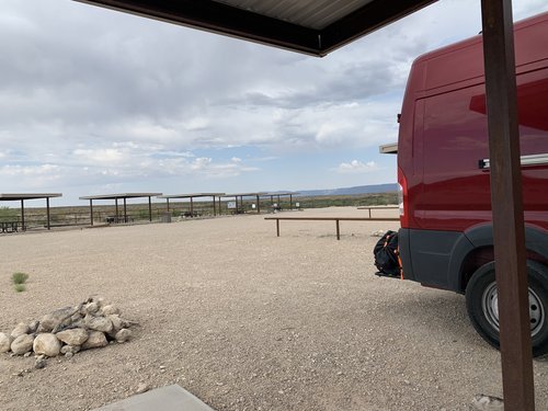
Sunset Reef Campground located in Carlsbad by the Guadalupe Mountains. I loved this location as it was a newer campground with excellent views.
Cost: You can stay here up to 5 days for FREE. No reservations needed
Amenities: There are 11 campsites (5 RV and 6 tent sites) here each with a picnic table, fire ring, trash cans, covered pavilion and vault toilets nearby that were very clean.
If you choose to walk the mountains take lots of water and a compass. As we were walking, we ended up going down the hill and couldn’t see which way was back to our camper until we had walked quite a way, so I recommend taking a compass if you walk this area.
APPS: Campendium, iOverlander, The Dyrt, FreeRoam
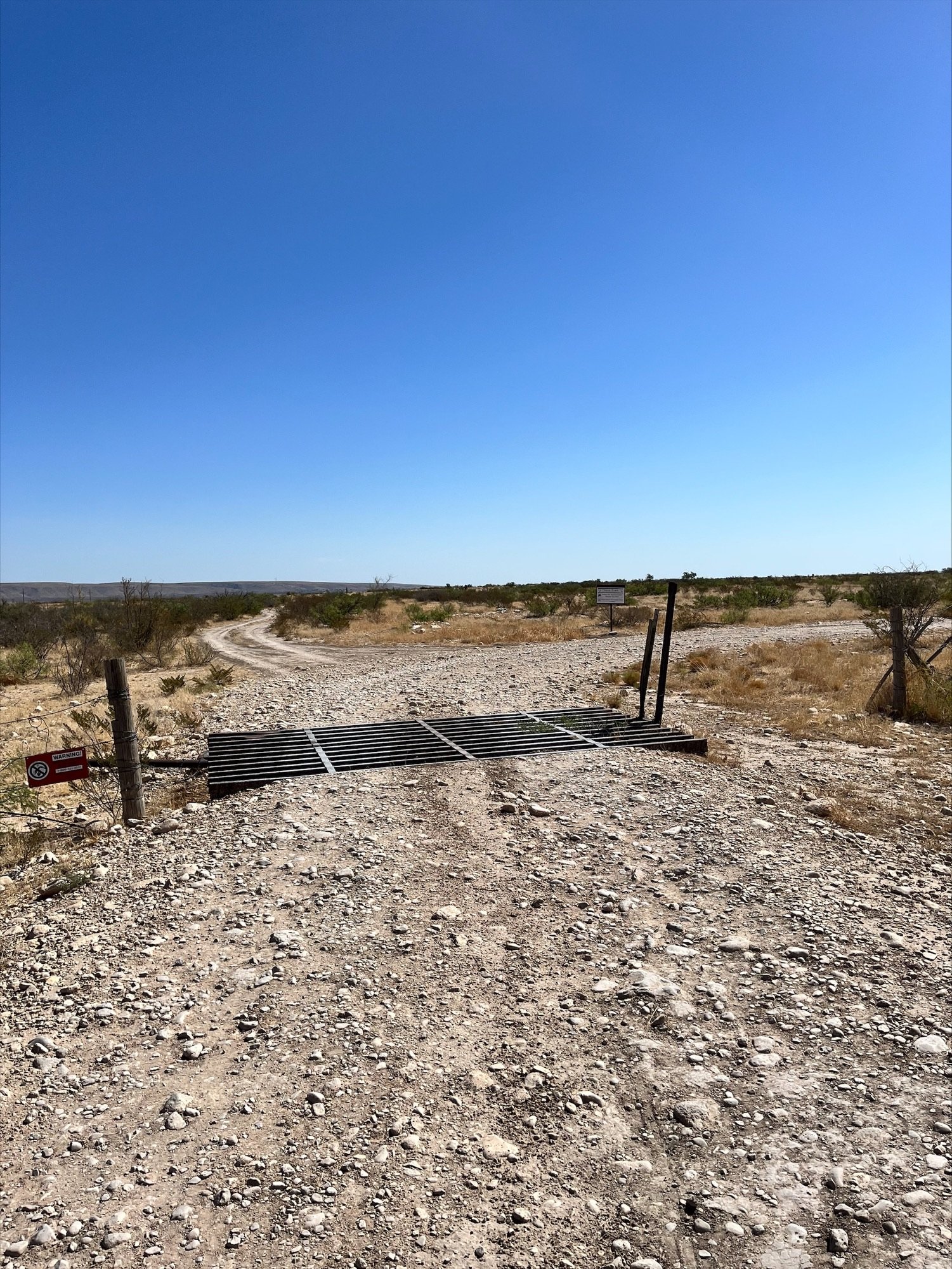
GPS: 32.1095, -104.4253 (beginning of road) GPS: 32.11938, -104.42466 (campground). There is no sign pointing you in the right direction once you turn off the highway. Once on this road you will turn right and cross a cattle guard and then go down the road quite a way. You will eventually see the Sunset Reef campground sign.
Cell: Yes, Verizon
More details on this campground can be found on this blog post
This is located 15 minutes from Carlsbad National Caverns.
Camping at or near Parks Ranch Campground in Carlsbad. This campsite is located on a gravel road off the main highway and has some larger rocks to drive over but doable in a camper or van. Other campers say there are two caves to explore at this campground.
Directions: From I-80 south turn left onto dirt road before mile marker 10. Once on that road you take an immediate left. The road is bumpy with several big rocks. Continue on this road until you cross a cattle guard and then turn right right away. Stay on this road which takes you straight to the campground. As I stated we didn’t make it to the campground but camped along this road as we rolled in later at night.
Cost: FREE. Maximum stay is 14 days.
Amenities: We chose to stay along the gravel road before the campground. I cannot say what the actual campground is like although many say it is a nice area. Our campsite did have a rock fire ring. The area was very quiet and peaceful.
APPS: Campendium (Parks Ranch Campground), iOverlander (Along creek to caves), The Dyrt (Parks Ranch Campground), FreeRoam
GPS: 32.10975, -104.40701 or GPS: 32.10975, -104.40701 (campground)
Cell signal: Yes, Verizon
Located 5 minutes from the entrance to Carlsbad National Caverns.
North Carolina
This spot is located on Avery Creek Road in Pisgah National Forest. There are several spots along this road, the road is gravel but easy to travel. You will know where the legal spots are by the sign shown below. There were other spots along this road to camp at, but they were not the designated spots per the National Forest regulations so camping at them is at your own risk. This was a great area and I highly recommend it.
Cost: FREE up to 14 days in a 30-day period.
Amenities: Spots marked for camping did have fire pits, parking area and tent pad. No other amenities. Hiking trails nearby.
APPS: iOverlander (Bennett Gap, Avery Creek Road)(Maxwell Cove), The Dyrt (Avery Creek Roadside Camping), Free Roam (Pisgah NF dispersed roadside camping)
GPS: 35.34753, -82.78328 beginning of road, 35.32162, -82.77553 end of road. You can start from either end to look for camping along this route. There are a couple roads for camping off of route 276 also.
Cell: Yes, Verizon
Recommended places to eat close by: Tupelo Honey Southern Kitchen, 12 College St, Asheville, NC. Hours: Sun-Thurs 9am to 9pm, Fri & Sat 9am to 10pm. There are a couple different Tupelo locations in this area. This address is where we ate, and it was really good.
This spot is located 1 hour 3 minutes from Biltmore Estates and 1 hour 21 minutes to Great Smokey Mountains National Park
Tennessee
We stayed along River Canyon Rd in Whitwell near Chattanooga. This is along the Tennessee river and allows for fishing and other water activities. Some spots are right next to the water while other spots are at a little more distance. This was a long sketchy road and narrow in some locations. Most spots were taken when we pulled in late at night. Go early to get a good spot by the water. This camping location was not my favorite, but it was free, and the water view was beautiful. I imagine it would be even more beautiful in the fall with the leaves changing colors.
Cost: FREE boondocking along the road.
Amenities: None
APPS: iOverlander (Tennessee wall wild camping, Tennessee river canyon road)
GPS: 35.06975, -85.39602
Cell signal: Yes, Verizon
Texas
We stayed at Padre Island National Seashore along the Gulf of Mexico. (Click on the link for more details about beach camping.
Cost: Because we have a National Park Access Pass, we were able to stay at this park for free. You can purchase a National Park annual pass for $80 a year which will get you into the National Parks for free.
Without NP pass: $10 for a day pass or $25 for a 7-day pass at this location. No reservations needed.
You can stay at this park for up to 14 days. You get to park right on the sand next to the ocean. It was amazing!
Amenities: Shower house, toilets plus pit toilets on the beach, Visitor center, kayaking, beach, swimming
APPS: iOverlander, Campendium, The Dyrt (North Beach and South Beach Campground), FreeRoam
GPS: 27.41536, -97.30180 This is one location, there are several areas to camp along this beach.
Utah
North Kolob Terrace Road in Virgin. This location we found by accident. I followed a spot that was closer to the main road according to an app I was looking at. I didn’t really like that spot as it was out in the open and I couldn’t really decide if it was a legal spot, so we kept driving and found this spot right before it got dark. It was a very nice and quiet spot. Definitely a good find and really close to Zion National Park.
Cost: This is BLM land and is FREE for up to 14 days. No reservations needed.
Amenities: There was a fire ring only. No restrooms.
APPS: The Dyrt, Campendium (North Creek Dispersed Camping), iOverlander (several)
GPS: 37.22033, -113.16161 or GPS: 37.21179, -113.17602
This spot is 22 minutes from Zion National Park
Manti-La Sal National Forest located in Moab. This was on a winding paved road except for the camp site pull-offs. Very quiet at night. You can camp with others or find a secluded spot to yourself.
Cost: FREE for up to 14 days. No reservation required.
Amenities: No amenities except a rock fire pit. No cell signal where we camped.
APPS:
GPS: 38.47056, -109.36281. This GPS is to a general location. There are several areas to camp at along this road.
Cell Signal: No, Verizon
This spot is located 34 minutes from Arches National Park
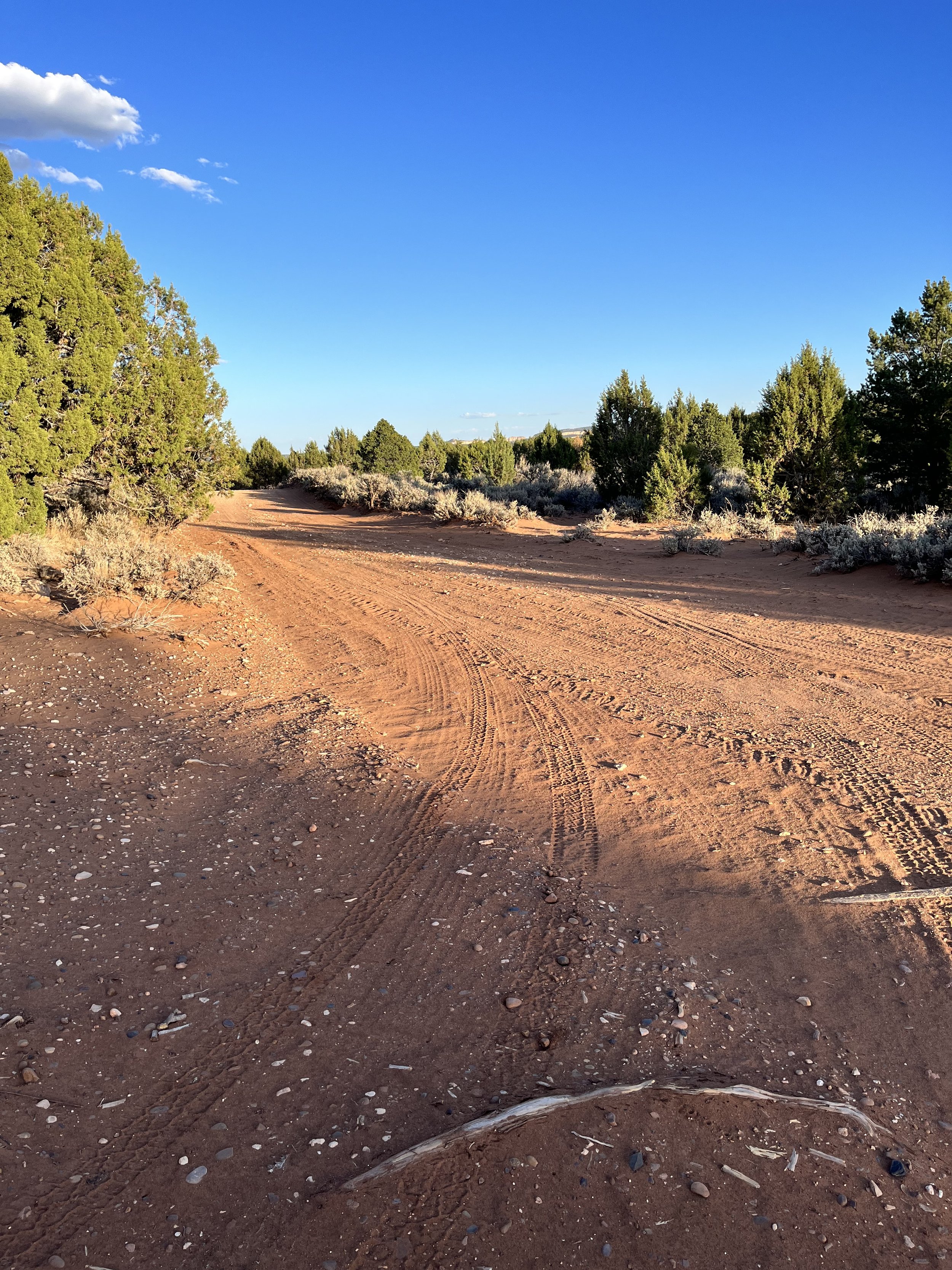
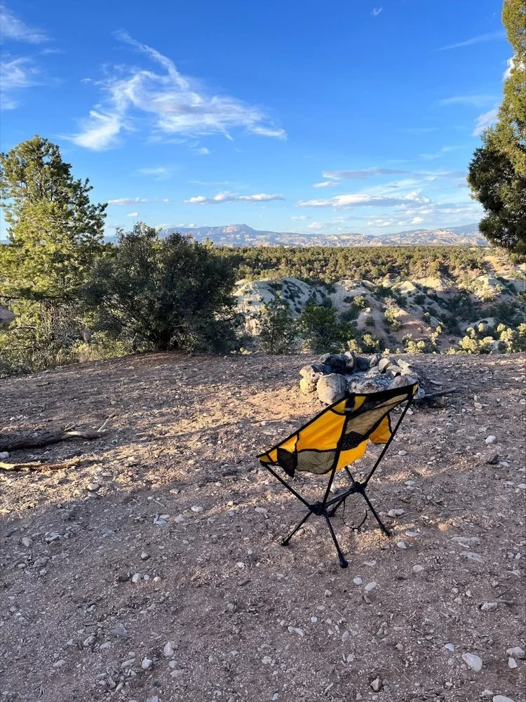
A camp spot in Kanab on Willis Creek Road. This was a beautiful location overlooking mountains. The drive to this location was quite scary in several places. There is no cell signal on this drive which made me nervous in case I was to get stuck. There is a sign that states 4-wheel drive recommended but we did fine in our campervan although I wouldn’t risk it again. Some areas were sandy and narrow so please use caution on this drive. I wouldn’t take this trip if it had been raining. GPS took us 1 hour on this road but on our way out the following day we were only on the road briefly and then onto a hard surface road. I wish I would have known about that, so I didn’t have to be on this dirt/gravel/sandy road for an hour the day before.
Do I recommend this location? I would not go there again but the view was beautiful and if you have 4-wheel drive it would be a great location. There is a cliff next to the campsite so be careful with young children.
Cost: FREE
Amenities: Rock fire pit, mountain view
APPS: iOverlander (USNEM 530)
GPS: 37.49401, -112.10456
Cell Signal: Yes, Verizon
YouTube video of location: https://youtu.be/u-ETdDazEos
Boondocking on N Bridge Sheep Road W was a great camping spot in Virgin near Zion National Park. This spot is located off a gravel road. This area had many different camping spots. You could camp as a group or by yourself. We did see a couple other campers, but they were far enough away you couldn’t hear them. I loved this location due to its beautiful view and close proximity to Zion National Park!
My maps said we were in Virgin UT but some of the apps say this is located in La Verkin in Hurricane Cliffs Recreational Area BLM.
Cost: FREE, no reservations needed. 14-day limit on BLM land within a 28-day time period.
Amenities: rock fire ring, mountain view
APPS: iOverlander (BLM camping & BLM 30 km Zion), Campendium (several, Hurricane Cliffs Designated Dispersed Campsites 36-48), The Dyrt (Hurricane Cliffs), FreeRoam (Hurricane Cliffs)
GPS: 37.18582, -113.22221
Cell Signal: Yes, Verizon
This spot is located 26 minutes from Zion National Park
Virginia
When we were headed on a trip to explore Virginia, I was worried about finding good boondocking locations throughout that state, but I tell you we found some of the best boondocking locations and I am excited to share those with you. This first one located in Damascus on Jeb Stuart Highway. This location is in the Mount Rogers National Recreation Area in Jefferson National Forest. Camp at least 200-feet from any water source and carry out all trash.
Cost: FREE, no reservations needed. 14-day limit on BLM land within a 28-day time period.
Amenities: rock fire ring, excellent creek next to campsite, forest surroundings, gravel campsite, mostly level.
Campfires: are allowed unless the area is on a fire ban restriction
APPS: iOverlander (Hwy 58/Virginia Creep 1 & 2)
GPS: 36.64550, -81.71988
Cell Signal: No, Verizon
This spot is located 36 minutes from Grayson Highlands State Park and 2 hours 33 minutes to Great Smokey Mountains National Park
Enjoy beautiful mountain views at this location. Located on top of Whitetop Mountain, this view offers a look at three different states on a clear day. Whitetop Mountain is the second highest mountain in Virginia at 5,525 feet and is located in the Mount Rogers National Recreation Area. Although the website says no camping, we camped in the parking lot at the top of the mountain without any problems. There was an alcove for camping and tent camping locations on the mountain side below the parking lot. There were two others camping when we were there. The road to the parking lot was windy, gravel and steeper in some areas. We had no trouble in our campervan and a smaller class C would be able to make this trek but nothing much larger. It was definitely cooler at night, in the lower 50’s, due to being on top of the mountain. Come prepared for cooler weather. Several people showed up for the sunset but after that, no one else came to this area.
Cost: FREE, no reservations needed
Amenities: rock fire ring in the tent camping area and the alcove below us, no fire rings in the parking lot. Beautiful mountain views and sunsets, gravel or grass campsites.
APPS: iOverlander (White Top Mountain)
GPS: 36.63724, -81.60743
Cell Signal: 0-2 bars off and on, Verizon
This spot is located 31 minutes from Grayson Highlands State Park and 3 hours 2 minutes to Great Smokey Mountains National Park
This beautiful campsite is located in Luray on Riverwater Road. The road to this campsite is narrow and a dead end. There is a small loop at the end of the road to turn around. I would be hesitant to take anything larger than a campervan down this road. In the loop there are several spots for car camping and before you get to the loop, there are about 3 large camping areas for tent camping. You park on the side of the road and walk the small path to the campsite. There is room for several tents at each site. This is located next to the South Fork Shenandoah River. I loved this location and would definitely stay here again.
Cost: FREE, no reservations needed
Amenities: rock fire ring, plenty of shade trees, river view with a rope swing. Small boat ramp in the loop drive. Pit toilets across from the tent camping sites up on a hill, bring your own toilet paper.
APPS: iOverlander (Down by the River)
GPS: 38.77000, -78.39386
Cell Signal: No, Verizon
This spot is located 53 minutes from Shenandoah National Park
This campsite is located on North Creek Road in Buchanan. Another beautiful location next to a creek with relaxing water sounds. This campsite isn’t very level so you might need to adjust your parking to get as level as possible. There are several campsites along this road.
Cost: FREE, no reservations needed
Amenities: rock fire ring, plenty of shade trees, creek next to campsite.
APPS: iOverlander (several locations on North Creek road)
GPS: 37.53437, -79.56453 or 37.53484, -79.56774. Due to lack of signal at campsite my GPS coordinates may be slightly off.
Cell Signal: No, Verizon
This spot is located 1 hour 47 minutes from Shenandoah National Park and 2 hour 41 minutes to New River Gorge National Park
West Virginia
Located in Beaver, on Little Laurel Trail Road, this location was a last minute find as both free campgrounds nearby were full. This is located right off the gravel road on a slight slant. You can hear the train nearby and New River was located next to the campsite.
Cost: FREE, no reservations needed. 14-day limit within a 28-day time period.
Amenities: rock fire ring, creek next to campsite, forest surroundings, gravel campsite, mostly level.
Campfires: are allowed unless the area is on a fire ban restriction
FREE primitive campgrounds nearby: Army Camp Campground in Prince GPS: 37.85850, -81.09855 and Grandview Sandbar Campground in Beaver GPS: 37.85685, -81.5349. Both are located within or near New River Gorge National Park and are FREE to camp at. Both of these campgrounds have composting toilets. APPS: Campendium (Grandview Sandbar Campground and Army Camp Campground)
New River Gorge National Park has 8 primitive campgrounds, all free and on a first come, first served basis.
APPS: iOverlander (Little Laurel Road (my own review))
GPS: 37.85300, -81.06951
Cell Signal: No, Verizon
This spot is located 48 minutes to New River Gorge National Park entrance and 2 hour 25 minutes to Grayson Highlands State Park
Apps I use to find camping locations:
iOverlander - my favorite
FreeRoam - this app is no longer available
NPS
Other Useful apps to download
Upside app (Use my invite code XJZTTH) - use this app to get cash back on gas purchases
Uber
ParkMobile, Transit, Go502, ParkChicago (all parking apps)
Ballpark (to visit MLB games)
Other, Not so glamorous places to camp for free:
Most of these locations accept overnight camping but if you are unsure, check with the store manager to see if they are ok with overnight parking.
Cracker Barrel (we have camped at this location a couple times and it has worked well)
Walmart
Home Depot
Casino’s
Hotel parking lots (not a legal spot but if you’re trying to find something last minute you might be able to secretly camp in the back of the hotel if you can blend in)
Bass Pro Shops
Marinas
Cabela’s
Truck Stops
Rest Stops
Beaches
Family/friends
Trail heads
If you like this article, check out these related posts
Always remember to leave no trace and pack out what you take in! Please keep these areas clean so others can continue to enjoy free camping. I love the fact that we can camp for free at some beautiful destinations. I want to be able to share these locations with others to enjoy so please respect the areas. The more I save on sleeping arrangements, the more I can spend on fun activities.
Please let me know if you have any questions on any of the locations and I will try my best to answer them. Comment below!!
I hope you can enjoy some peace and quiet at your next boondocking location.
Until then….
Enjoy your journey,
Meet the author: Jennifer
I am a girl who loves to travel with my family and enjoys sharing expert family travel advice. I am a content creator and influencer on Instagram with years of travel experience and provide readers with advice, tips, and details on adventurous family travel and tips on saving money while boondocking or traveling across the US. You can usually find me dreaming up our next epic vacation or outside exploring natural landscapes. I am a fearless roadtripper who isn’t afraid to explore new and off the path adventures.
Follow me on social media to discover more travel ideas
Instagram @adoptinglifesjourney
Pinterest /adoptinglifesjourney
If this post was helpful, follow me on Instagram @adoptinglifesjourney and
Hashtag your photos at #adoptinglifesjourney
Need help planning a vacation? I am also a travel agent. Follow me on social media and send me a DM @exploringsunsetstravel for more travel inspiration or for a FREE travel quote.

















Nassau is a bustling cruise port and a popular destination when traveling in the Bahamas on shorter cruises from Florida. This port offers everything from mouthwatering local cuisine to stunning white-sand beaches and rich Bahamian heritage.